Research a Neighborhood – Unknown Address
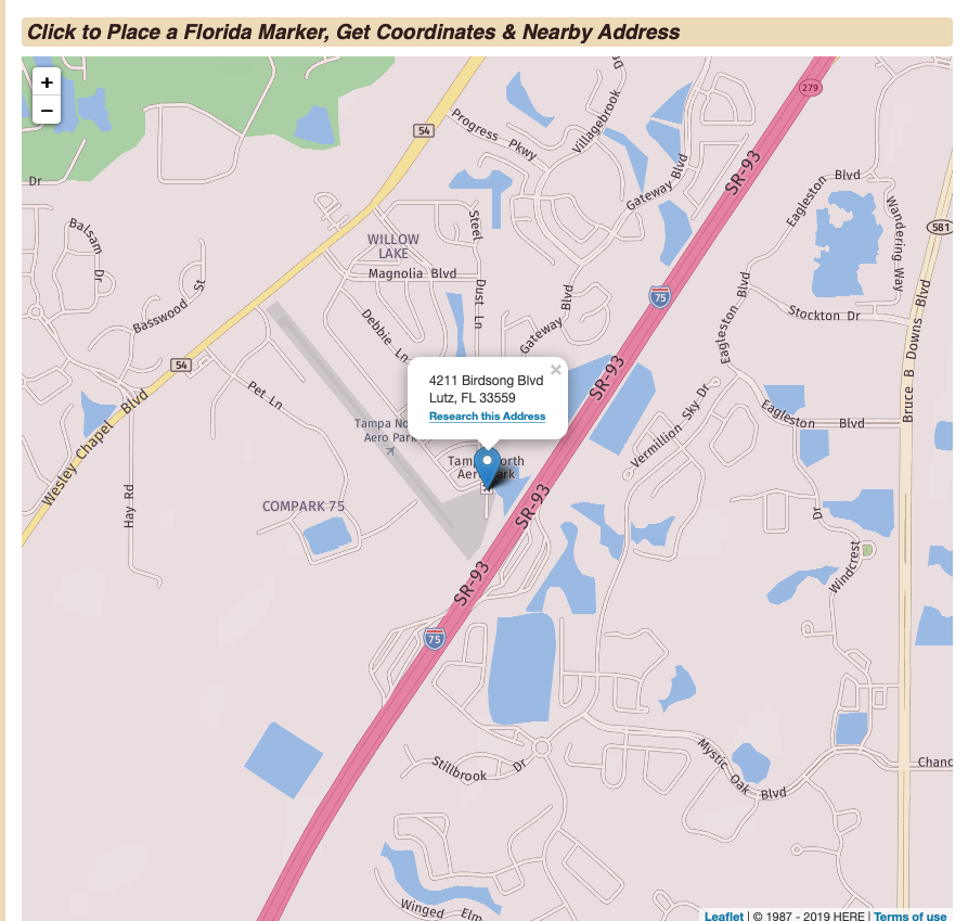
Each state gazetteer has a Reverse Geocoder Map that allows you to select a very specific location, mark a spot and get both the coordinates for the location and the nearest address. The example below uses a Florida location, but the same tool is available in each state gazetteer.
Here are the 3 simple steps to accomplish this task:
- Go to the Reverse Geocoder Map for your state. The URL for Florida is https://florida.hometownlocator.com/maps/coordinates2.cfm. Here are two examples for other states: https://northcarolina.hometownlocator.com/maps/coordinates2.cfm, https://california.hometownlocator.com/maps/coordinates2.cfm, etc.
- Use your mouse to drag the map window to the general area of interest and then use the +/- controls in the upper left of the map to zoom in on the area of interest. Zoom in as much as possible to help you place your marker exactly on the location of interest and then click on the spot. The system will drop a pin on that location and give you the nearest street address as well as the coordinates.
- When you follow the link that says, Research this Address, you get the same information that is available when you use the HTL Address Research Tool.
In the example, I've dropped a pin on a small airport north of Tampa, Florida.